Toronto topographic map
You can find on this page the Toronto topographic map to print and to download in PDF. The Toronto elevation map present the topography, river and relief of Toronto in Canada.
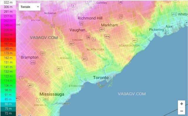
Toronto elevation map
The Toronto topographic map shows elevation, hills and landforms in Toronto. This elevation map of Toronto will allow you to know topography, river and relief of Toronto in Canada. The Toronto topographic map is downloadable in PDF, printable and free.
Toronto elevation differences range from 75 metres (246 ft) above-sea-level at the Lake Ontario shore to 209 m (686 ft) ASL near the York University grounds in the city north end at the intersection of Keele Street and Steeles Avenue as its shown in Toronto elevation map. There are occasional hilly areas, in particular midtown Toronto has a number of rolling hills, some of which are of considerable height. Lake Ontario remains occasionally visible from the peaks of these ridges as far north as Eglinton Avenue, 7 to 8 kilometres (4.3 to 5.0 mi) inland.